


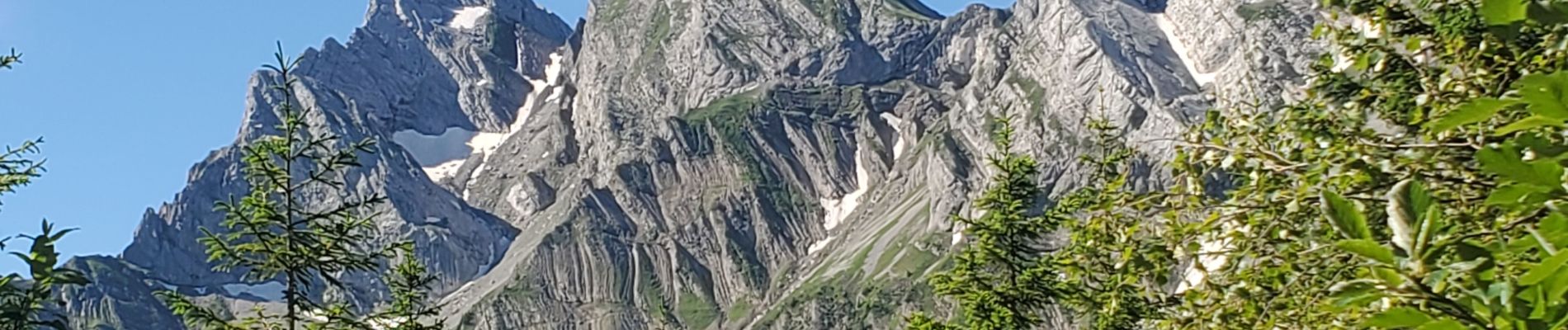
aravis aiguille verte combe borderan 12kms 987m

Danielba
User GUIDE
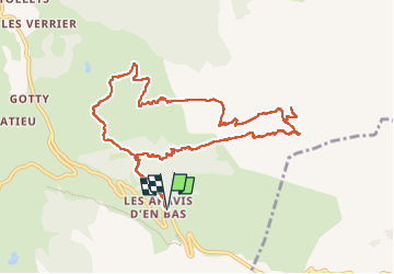

Length
11.6 km

Max alt
2317 m

Uphill gradient
1021 m
Km-Effort
25 km

Min alt
1386 m

Downhill gradient
1020 m
Boucle
Yes
Creation date :
2024-07-05 07:06:38.142
Updated on :
2024-07-05 15:53:04.724
7h14
Difficulty : Medium

FREE GPS app for hiking
 SityTrail
IGN / Geographical institutes
SityTrail Plus
The world is yours!
About
Trail Walking of 11.6 km to be discovered at Auvergne-Rhône-Alpes, Upper Savoy, La Clusaz. This trail is proposed by Danielba .
Photos


Positioning
Country:
France
Region :
Auvergne-Rhône-Alpes
Department/Province :
Upper Savoy
Municipality :
La Clusaz
Location:
Unknown
Start:(Dec)
Start:(UTM)
302237 ; 5083751 (32T) N.
Comments